UCGIS Elections, 2020
The Nominating Committee and the Board of Directors are honored to present these individuals to the UCGIS delegates for consideration in the 2020 elections. Online voting by delegates will begin on Friday May 22 and will conclude on Thursday May 28, 2020. Selected individuals will begin their positions on July 1, 2020.
President-Elect
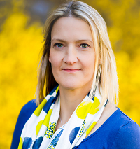 Jane Read, Syracuse University Jane Read, Syracuse University
Bio: Jane Read, Associate Professor in the Department of Geography at Syracuse University, holds degrees from the University of London (B.Sc. Environmental Science 1987; M.Sc. Surveying 1990) and a PhD in Geography (1999) from Louisiana State University. She has served on the faculty at Syracuse University since 1999 and as Director of Undergraduate Studies in Geography from 2014-2018. Read has a firm and long-standing commitment to UCGIS. She has served continuously as Syracuse University’s lead delegate to UCGIS since 1999. She chaired the Communications Committee from 2005-2008, served on the Board of Directors (2012-2015) and the Nominations committee in 2016, among other roles. She is a Fellow of the inaugural cohort of the TRELIS (Training and Retaining Leaders in STEM – Geospatial Sciences) 2018 program. Her research focuses on how geospatial technologies can be applied to environmental problems, including land change and human-environment interactions, and how career pipelines into STEM fields associated with geospatial technologies can be expanded and diversified.
Statement: I have been involved with UCGIS for over 20 years, and have reaped the benefits of being part of a supportive community both professionally and intellectually. If elected to serve, I see my primary role as working to continue efforts to maintain, expand, and diversify UCGIS membership, including increasing the value proposition of the organization to its membership. I write this at the end of March, in the midst of the COVID-19 crisis. The world is changing rapidly and we face uncertainty in the near- and long-term in many respects, including professional, economic, institutional, and geopolitical, to name but a few. The health of the organization is dependent on the strength of its members. I believe it will be vitally important for the UCGIS leadership team to hear the concerns of all our members – individually, institutionally, and collectively, and to find ways to support the geospatial community as we all do our work. This is also a time when our UCGIS community can provide direction in responding to and promoting geospatial research and teaching needs emerging as a result of the epidemic. I would work with the executive committee, board, and committee chairs to assure the continued health of the organization, support and expand the slate of projects that UCGIS supports, including professional development opportunities and research and teaching developments, and in thinking about the future of geospatial work.
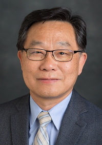 Shih-Lung Shaw, University of Tennessee Shih-Lung Shaw, University of Tennessee
Bio: Shih-Lung Shaw is an Alvin and Sally Beaman Professor of Geography at University of Tennessee, Knoxville (UTK). He received his Ph.D. and M.A. degrees from The Ohio State University and his B.S. degree from National Taiwan University. His research interests include geographic information science, transportation geography, time geography, and spatiotemporal analysis of human dynamics. Currently, he chairs the UCGIS Research Committee (2017-2020), with prior service as Chair of the Transportation Geography Specialty Group (2000-2002) and Secretary/Treasurer of the GIS Specialty Group (1994-1996) of the American Association of Geographers (AAG), as well as Head of the Geography Department (2007-2010) and Interim Associate Provost of International Education (2017-2018) at UTK. Additionally, he is a Fellow of the American Association for Advancement of Science (AAAS), an Associate Editor of Travel Behaviour and Society, and an editorial board member of IJGIS, Journal of Transport Geography, among other journals.
Statement: During my past three years of service as the Chair of UCGIS Research Committee, I have had the wonderful opportunity to learn more about and develop a greater appreciation for the organization’s work and impact. As the field of GIScience continues to evolve, UCGIS has played an important role in supporting the communities in GIScience research, education, and policy endeavors. The future of UCGIS will be shaped by all of us who want to contribute to this organization and continue its success of the past twenty-five years. As the President-Elect, I will work with all of you to develop new opportunities and collaborations to move GIScience forward. I have observed that UCGIS accomplishments are the outcome of collective efforts of everyone involved. I would like to continue this tradition and encourage active participation from everyone in our pursuit of future GIScience education needs, emerging GIScience research topics, and important GIScience-related policies.
Members, Board of Directors (2 to be elected):
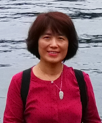 Angela Yao, University of Georgia Angela Yao, University of Georgia
Bio: Xiaobai Angela Yao is Professor of Geography at the University of Georgia. She received a Ph.D. in Geography from University at Buffalo, SUNY in 2002, and previously an M.Sc. from ITC (now Twente University) in the Netherlands, as well as a B.S. from WTUSM (now Wuhan University) in China. All degrees were obtained with a concentration on GIScience and urban analysis. She co-organized a UCGIS workshop in 2003 and has been a UCGIS delegate since 2013. Her notable leadership services in the discipline include serving as chair of the International Cartographic Association (ICA) Commission on Geospatial Analysis and Modeling (2015 – current) and vice chair of the commission (2011-2015), board member of the International association of Chinese professionals in GIScience (2010-2012), SEDAAG state representative for Georgia (2005-2007), and committee member on the AAG standards for Geographic Data committee (2003-2006). Other disciplinary service contributions include co-organizing a number of international symposiums and workshops. Her research and teaching interests center on geospatial analysis and modeling techniques and their applications for human movements and health research.
Statement: I am honored to be considered as a nominee for election to the UCGIS Board of Directors. I have been involved in UCGIS activities since the very beginning of my academic career. In various ways of participation in, or service for, UCGIS events in the past couple of decades, I am convinced that UCGIS is an incredibly valuable community for GIScience scholars and professionals. It not only coordinates efforts in the broad GIScience community for the advancement of GIScience research and education, but also provides professional development opportunities for young scholars and students. It would be an honor and privilege to serve on the board of directors. I believe my long-time involvement in UCGIS activities and my leadership experiences at other national and international professional associations will help me to work smoothly with other members, for continuing healthy growth of the association. If elected, I will pay my due diligence and invest all necessary time and resources at my disposal for the benefit of UCGIS. With collective efforts of the BOD, I hope to see that UCGIS continues to make significant impacts on GIScience research and education.
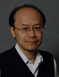 David Wong, George Mason University David Wong, George Mason University
Bio: David Wong, Professor in Geography & Geoinformation Science Department at George Mason University. He has broad research interests, ranging from the technical areas in geovisualization, to the more social-oriented issues in spatial epidemiology. His primary research interests are in spatial analysis and statistics, and population analysis, particularly in measuring segregation. He has also developed new concepts in mapping data by incorporating the error information of estimates, an important research topic on spatial data quality. He has edited two book volumes, co-authored three books and published more than 13 book-chapters and 80 papers in peer-reviewed journals. Some of his research funding supports were provided by NOAA, USGS, HUD, U.S. Census Bureau and NIH (NICHD and NCI through R01, R03 and contracts). He has served on the editorial boards of seven international journals in GIS, spatial analysis and population, including Geographical Analysis and Computers, Environment and Urban Systems.
Statement: I witnessed the transition of the center of GIS/GIScience community from NCGIA to UCGIS two decades ago, and the evolving missions of UCGIS over the last decade and a half. Although the membership of the organization had expanded in earlier years, it has become more fluid recently, possibly an indication that the organization may not be serving the community effectively. The current mission statement was adopted in December 2012. One of the reasons I would like to serve as on the Board of UCGIS is to work with the officials, members and the community to ensure the long-term viability of the organization.
The multidisciplinary nature of GIScience legitimately brings together researchers, educators and practitioners from a wide spectrum of disciplines, forming a highly inclusive and diverse community. Although some GIScience researchers across disciplines have collaborated, many still work within one’s own silo, not recognizing how the depth of other disciplines may contribute to one’s own research in GIScience. As a geographer, my second objective to serve on the UCGIS Board is to work with members in GIScience community to take full advantage of the rich intellectual resources in geographical-spatial concepts, theories, models and methods potential relevant to GIScience.
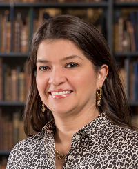 Miriam Olivares, Yale University Miriam Olivares, Yale University
Bio: Miriam Olivares is the GIS Librarian at Yale University. With 19 years of geospatial experience, she coordinates GIS support services in higher education and frequently advises about GIS libraries. At Yale, and previously at Texas A&M University, she connects experts and teaches and consults GIS, thus enabling others’ geospatial power to promote teaching and cutting-edge research. She was featured in the book Women and GIS: Mapping their Stories, has published scholarly articles and book chapters, has participated in binational GIS panels, and collaborated in Australia, North and Central America, and Somalia. Her interdisciplinary research includes crime analysis, natural hazards, and marine conservation, among other subjects. Miriam served as the international chair for GIS LATAM’s Workshop in Spatial Intelligence, is a member of the board of directors of New Haven-based Junta for Progressive Action, is a fellow of the Yale Timothy Dwight College, and was co-chair of Yale Women in Tech.
Statement: I am honored to be considered to join the UCGIS Board of Directors. I am so eager to serve my GIScience community that I joined the Education Committee as a volunteer even before Yale became a UCGIS member. I am excited to bring a comprehensive perspective to critical discussions, which includes an understanding of shared and opposing visions of faculty and students. I can be a connector between UCGIS and GIS libraries, opening potential synergies, and membership. My role in higher-education has been possible through collaborations with GIS&T faculty colleagues, who have allowed me to learn, contribute, and propose new ways to enable the evolution and achievement of their GIS endeavors. My approach to getting things done with a low budget and persistent enthusiasm has gained me the trust of colleagues and decision-makers. Now that COVID-19 has made evident the required evolution and adaptation of GIS&T education, I hope more than ever to help the UCGIS leadership and members, to position UCGIS as the agent of change that our discipline demands. I offer my passion for GIS and the ability to network across private, public, and academic sectors to bring opportunities and empower our consortium to promote an agile, adaptive, and rising GIScience.
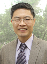 Yongwan Chun, University of Texas at Dallas Yongwan Chun, University of Texas at Dallas
Bio: Yongwan Chun is an associate professor of Geospatial Information Sciences at the University of Texas at Dallas (UTD). He obtained a PhD in geography and a master’s in applied statistics from the Ohio State University. His research focuses on spatial analytical and spatial statistical methods in GIScience, addressing issues in geographic data uncertainty, spatial interaction models, public health, and urban crime. He has 82 publications, including 47 journal articles, 2 co-authored books, 14 book chapters, and 10 proceedings. He received the Emerging Scholar Award (2017) from the Spatial Analysis and Modeling (SAM) Specialty Group of the American Association of Geographers (AAG), and currently serves as chair of the SAM SG. He was a past representative of UTD to the UCGIS annual symposium (2016), and has served on the organizing committees of international conferences (Geocomputation 2015, Spatial Statistics 2013) and award committees (Nystrom Award 2020, Medals at Spatial Accuracy 2020).
Statement: I am honored to be considered to serve as a member of the UCGIS Board of Directors. The UCGIS already has left remarkable footprints in the field of GIScience, continuously and successfully promoting GIScience through initiatives such as the recent development of the AP GIS&T course proposal. I am very willing to serve this organization in its ongoing major leadership role in GIScience research and education across academic, government, private, and public communities. If elected, I would be strongly committed to assisting the UCGIS in achieving its mission, and I would actively engage in its leadership activities. Specifically, I would encourage research collaborations among UCGIS members, as well as promote the involvement of people who are not in the UCGIS. Especially, I would promote people in non-UCGIS institutions to encourage their institutions to join. I would strongly support UCGIS programs, such as its Summer School and its webinars, to expand research and education opportunities for young researchers so that we can strengthen the next generation of GIScience scholars.
|

 Jane Read, Syracuse University
 Shih-Lung Shaw, University of Tennessee
 Angela Yao, University of Georgia
 David Wong, George Mason University
 Miriam Olivares, Yale University
 Yongwan Chun, University of Texas at Dallas